Betterview, an InsurTech provider of actionable intelligence to property and casualty (P&C) insurance companies, has partnered with locations intelligence and aerial imagery company Nearmap.
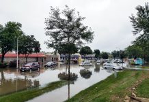
Betterview said this partnership will enable customers of its recently released CAT Response System (CAT-RS) to assess which insured properties were impacted by catastrophic events.
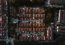
Nearmap ImpactResponse captures high resolution imagery shortly after severe weather events, including windstorms, hurricanes, tornados, and wildfires. Combined with Betterview’s CAT-RS, this imagery helps insurers respond proactively to customers in need and speeds recovery efforts.
What’s more, is insurers also benefit from seeing what has happened to properties before first notice of loss (FNOL) or a claims adjuster can physically reach the location improving operational efficiency.
David Lyman, co-founder and CEO at Betterview, said, “This partnership is a great example of two companies joining forces to create a powerful solution. Our predictive analytics, computer vision tools, and claim verification workflow with an intuitive UI, paired with Nearmap’s market-leading imagery, will help insurers quickly respond to their insureds in times of crisis while simultaneously reducing claims expenses.”
Copyright © 2022 FinTech Global


